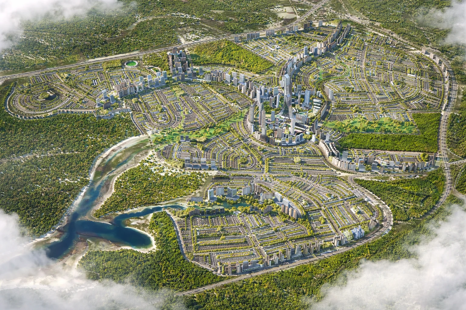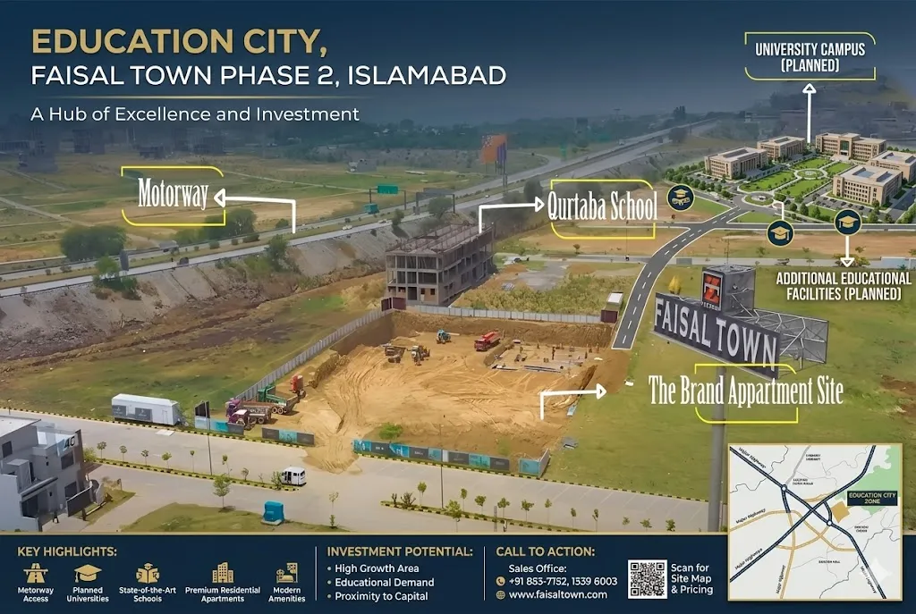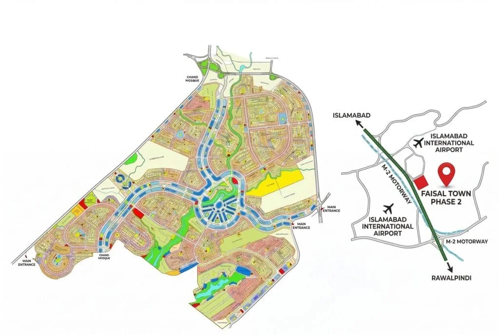
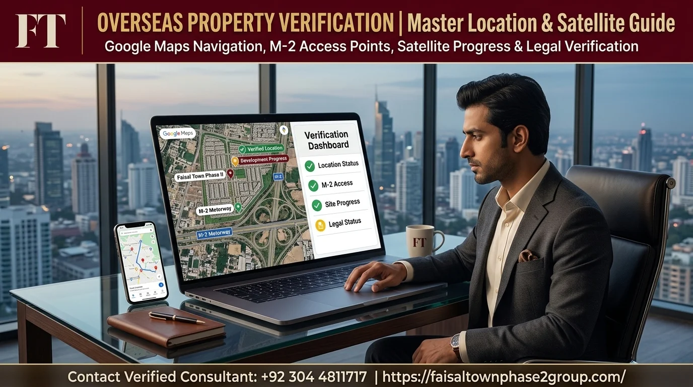
If you’re an overseas Pakistani considering a plot in Faisal Town Phase 2, checking the Faisal Town Phase 2 location Google Map yourself is one of the simplest, most reliable things you can do before booking. You can’t drive out and see the site in person from Doha, London, or Dubai, but you can verify a great deal about the project’s actual location and progress from your own laptop.
This guide shows you exactly where Faisal Town Phase 2 sits on the map, how to use satellite view to check development progress, and what to watch for so you’re not relying purely on a developer’s own marketing images.
Overview:
When you’re buying property from thousands of miles away, a map isn’t just a nice reference, it’s one of the few tools you actually have to independently confirm what a developer tells you. Marketing brochures show polished renders and promises. A live satellite map shows you what’s actually there right now.
Who This Guide Is For
This guide is written for overseas Pakistanis considering a plot in Faisal Town Phase 2 who want to independently confirm the project’s location and general progress using Google Maps.
A Note on Using Maps as One of Several Verification Tools
A map is genuinely useful, but it can’t tell you everything. It won’t confirm a project’s legal or NOC status, and it can’t verify who actually owns a specific plot. Use it alongside other checks, like confirming NOC status directly with RDA and verifying contact details independently.
Faisal Town Phase 2’s Location on Google Maps
Finding Faisal Town Phase 2 on Google Maps is straightforward once you know what to search for and which nearby landmarks to use as reference points.
Approximate Coordinates and How to Search for Them
The most reliable way to find Faisal Town Phase 2 on Google Maps is to search the project name directly, or search for the Thalian Interchange on the M-2 Motorway and look at the surrounding area. Exact coordinates for a specific plot or sector are best confirmed directly with your dealer.
Nearby Landmarks Visible on the Map
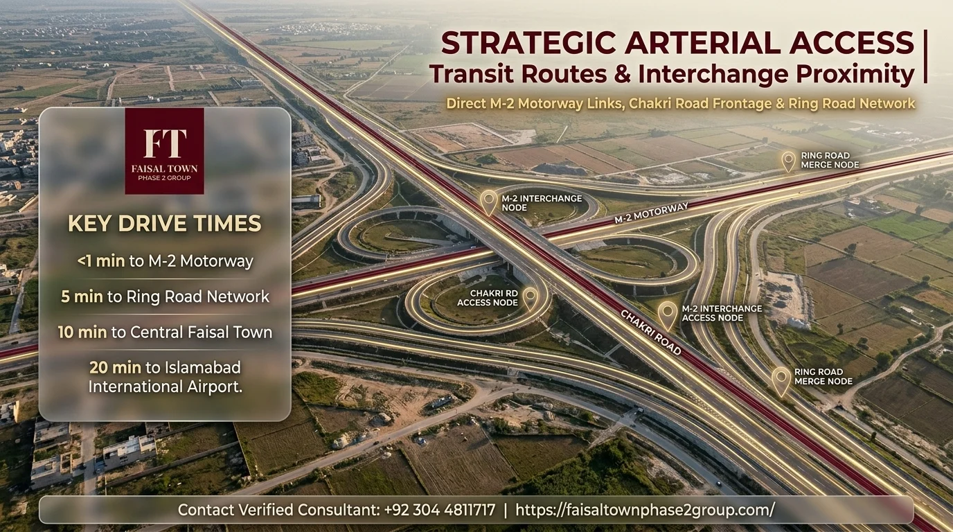
Once you’ve located the general area, you should be able to identify a few reference points on the map:
- The M-2 Motorway running past the site
- Chakri Road along one side of the project
- The general direction toward New Islamabad International Airport
Seeing these landmarks positioned correctly relative to each other is a useful first check that you’re looking at the genuine area.
How to Verify the Location Yourself From Abroad
Once you’ve found the general area on the map, the next step is actually using it to check something meaningful.
Using Google Maps Satellite View to Check Development Progress
Switching to satellite view on Google Maps lets you see the actual state of the land, roads, and any construction that’s visibly underway, rather than relying on a developer’s promotional images.
Cross-Checking Against RDA Records
Satellite imagery shows you what’s physically there, but it can’t confirm whether the land is legally approved for that development. For that, you need to check directly with the Rawalpindi Development Authority, since Faisal Town Phase 2’s NOC status and approval details are recorded there, not on any map.
What Genuine On-Ground Progress Looks Like on Satellite Imagery
Real development on satellite imagery typically shows:
- Visible road grids
- Cleared and leveled land
- In more advanced sectors, actual construction or completed structures
Land that still looks like open agricultural fields with no visible road network, despite being marketed as an active or possession-ready sector, is worth asking more questions about directly with your dealer.

Is Faisal Town Phase 2 in Islamabad or Rawalpindi — Quick Recap
If you’ve read our dedicated guide on this topic, you’ll already know the short answer: Faisal Town Phase 2 falls under the Rawalpindi Development Authority’s jurisdiction, even though it’s frequently marketed using “Islamabad” in branding and page names due to its proximity to the capital and its airport.
Why the Map Alone Doesn’t Answer the Jurisdiction Question
A map shows you physical location, but administrative jurisdiction isn’t something you can read off Google Maps by looking at where a pin lands. Two projects can sit close to each other geographically while falling under entirely different development authorities.
Distance and Access Points Shown on the Map
Beyond confirming the general location, the map is also useful for understanding how Faisal Town Phase 2 connects to the surrounding road network.
| Access Point | Approx. Distance/Time |
| Thalian Interchange (M-2 Motorway) | ~4 minutes |
| Chakri Road frontage | ~10 km stretch |
| Rawalpindi Ring Road | ~8 minutes |
| New Islamabad International Airport | Confirm with dealer |
Thalian Interchange and M-2 Motorway
The Thalian Interchange on the M-2 Motorway sits close to Faisal Town Phase 2, reported to be roughly a 4-minute drive from the project.
Chakri Road and Rawalpindi Ring Road
Chakri Road runs along a significant stretch of the project, reportedly around 10 kilometers of frontage. The Rawalpindi Ring Road, reported to be roughly an 8-minute drive away, is another access point worth locating on the map.
New Islamabad International Airport
The project’s proximity to New Islamabad International Airport is one of the most frequently cited location advantages in its marketing. Exact drive time can vary depending on traffic and route, so confirm current travel time with your dealer if this matters to your decision.
Red Flags to Watch For When Checking a Housing Society’s Map
Not every housing society’s map tells the full story, and knowing what to look for helps you spot the difference between a project that’s genuinely progressing and one that’s mostly still marketing renders.
Undeveloped Land Marketed as Developed
If a sector is described as developed or possession-ready, but satellite imagery still shows open, unmarked land with no visible road grid, that’s a clear mismatch worth questioning directly.
Vague or Missing Coordinates
A legitimate housing project should be locatable with reasonable precision on a map, tied to identifiable landmarks or roads. If a project’s location is described only in vague terms, that’s worth treating as a reason to ask more questions.

Who Developed Faisal Town Phase 2
Knowing who’s actually behind a project adds useful context when you’re checking its location and progress from abroad.
Zedem International and Faisal Town Group
Faisal Town Phase 2 is developed under Faisal Town Group, originally founded as Zedem International by Chaudhry Abdul Majeed in 2013 before being rebranded. Our dedicated guide on the company’s background covers this history and the group’s wider project portfolio in more detail.
Common Mistakes Overseas Buyers Make When Checking Location Online
- Relying only on images from a dealer, without independently searching Google Maps
- Assuming “Islamabad” in the name or URL means the project is legally within Islamabad’s jurisdiction
- Treating satellite imagery as fully up to date, without accounting for lag time
- Checking location but skipping the separate step of verifying legal or NOC status
Ready to Learn More About the Location? Contact Us Today
If you have questions about Faisal Town Phase 2’s exact location, access points, or current development progress in a specific sector, our team can walk you through the details directly. Call or WhatsApp us at +92 304 4811717, or email info@faisaltownphase2group.com.